Color range
We can set the start, middle, and end colors. Then specify the distribution options. Based on the specified distribution type and using the provided colors, make a lot of hues that delivers a presentation like a heat map. The start color applies to the low end of the data range and the end color applies to data at the high end of the data range.
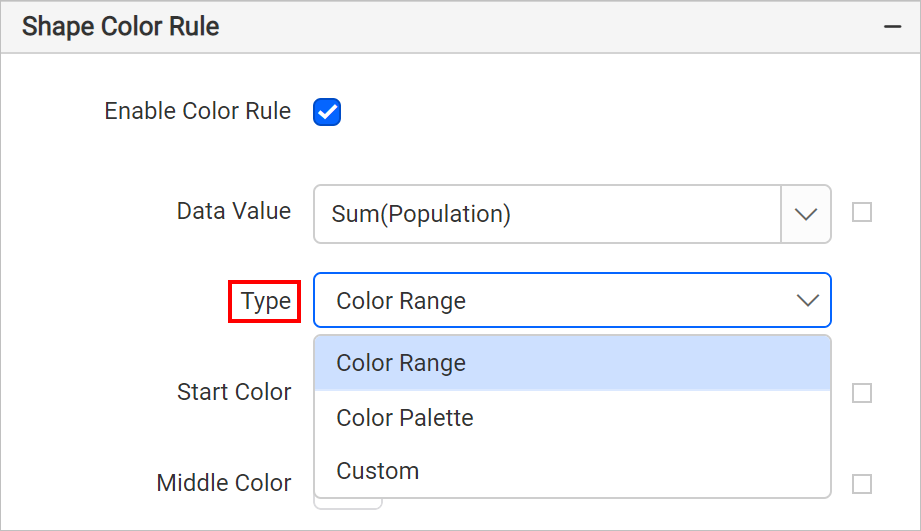
Specify the required colors in Start color, Middle color and End color fields. By default red, yellow and green colors will be applied on map surface.
- Start color - to use for the lowest range.
- Middle color - to use for the middle range.
- End color - to use for the highest range.
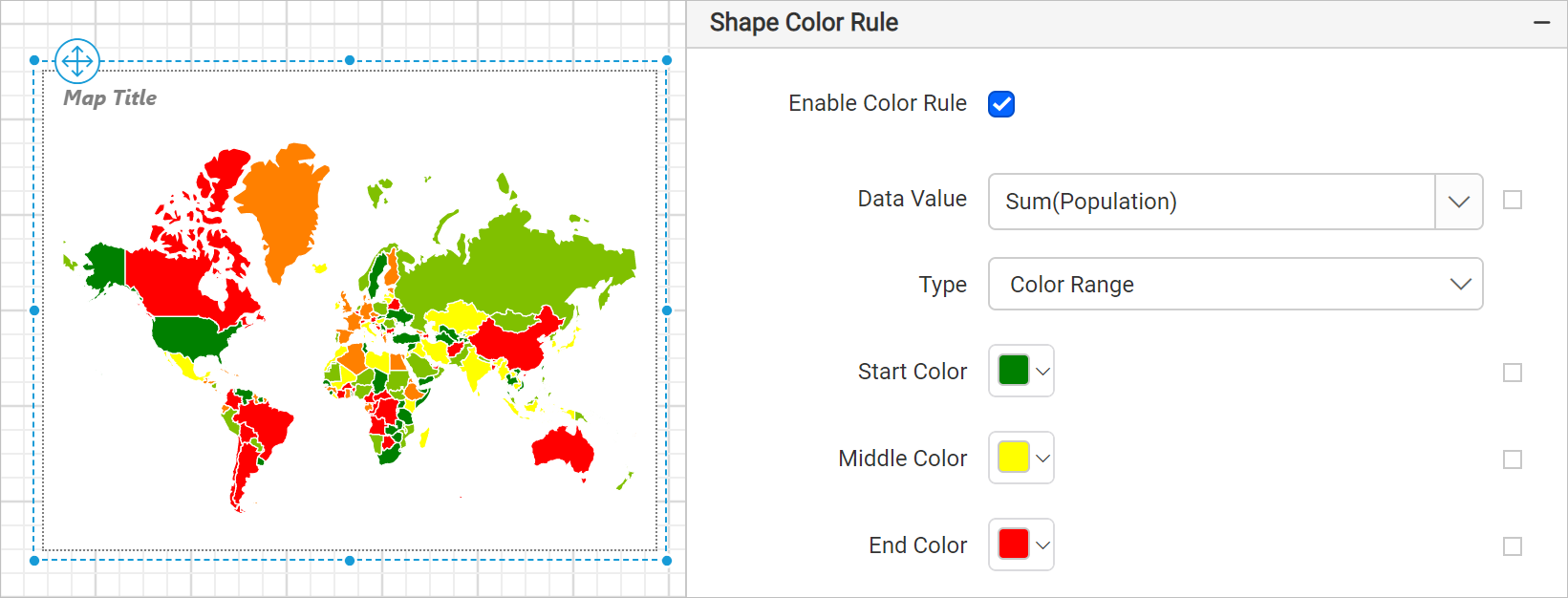
For example, to display population of each country on a map, set the color codes #CFF09E, #79BD9B, #1074AD, respectively. Now, the map design with sample will look like below,
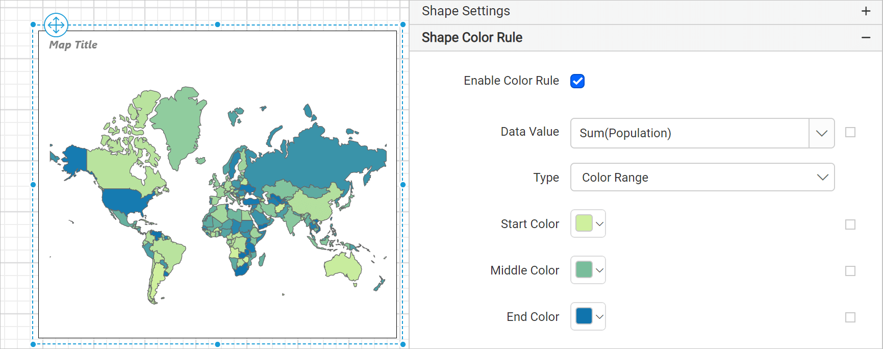
On report processing these three color will be distributed on map surface based on the distribution type that delivers a presentation like a heat map.
Use case
Refer the Design map using color range rule section to design a world population analysis report using color range rule in map report item.